
Plymouth County ZIP Coverage
Plymouth County has 27 municipal record systems, but postal delivery follows a different geography. The verified coverage inventory below contains 63 ZIPs within or partly within the county-area set. It includes standard delivery ZIPs, PO Box labels, and unique-organization ZIPs. The postal label in the third column identifies the locality captured in the dataset, not a promised physical post-office counter. A listed ZIP can extend into Barnstable or Bristol County, and a municipality can use a postal last line associated with another town.
| ZIP | Areas covered | Postal label | Notes |
|---|---|---|---|
| 02018 | Accord/Norwell area | Accord | PO Box locality label |
| 02020 | Brant Rock/Marshfield | Brant Rock | PO Box locality label |
| 02040 | Greenbush/Scituate | Greenbush | PO Box locality label |
| 02041 | Green Harbor/Marshfield | Green Harbor | PO Box locality label |
| 02043 | Hingham | Hingham | Standard; may cross municipal or county context |
| 02044 | Hingham | Hingham | Unique organization |
| 02045 | Hull | Hull | Standard |
| 02047 | Humarock/Scituate | Humarock | PO Box locality label |
| 02050 | Marshfield | Marshfield | Standard |
| 02051 | Marshfield Hills | Marshfield Hills | PO Box locality label |
| 02055 | Minot/Scituate | Minot | PO Box locality label |
| 02059 | North Marshfield | North Marshfield | PO Box locality label |
| 02060 | North Scituate | North Scituate | PO Box locality label |
| 02061 | Norwell | Norwell | Standard |
| 02065 | Ocean Bluff | Ocean Bluff | PO Box locality label |
| 02066 | Scituate | Scituate | Standard |
| 02301 | Brockton | Brockton | Standard |
| 02302 | Brockton | Brockton | Standard |
| 02303 | Brockton | Brockton | PO Box |
| 02304 | Brockton | Brockton | PO Box |
| 02305 | Brockton | Brockton | PO Box |
| 02324 | Bridgewater | Bridgewater | Standard |
| 02325 | Bridgewater | Bridgewater | Unique organization |
| 02327 | Bryantville/Pembroke | Bryantville | PO Box locality label |
| 02330 | Carver | Carver | Standard |
| 02331 | Duxbury | Duxbury | PO Box locality label |
| 02332 | Duxbury | Duxbury | Standard |
| 02333 | East Bridgewater | East Bridgewater | Standard |
| 02337 | Elmwood/East Bridgewater | Elmwood | PO Box locality label |
| 02338 | Halifax | Halifax | Standard |
| 02339 | Hanover | Hanover | Standard |
| 02341 | Hanson | Hanson | Standard |
| 02344 | Middleboro/Middleborough | Middleboro | Unique organization |
| 02345 | Manomet/Plymouth | Manomet | PO Box locality label |
| 02346 | Middleboro/Middleborough | Middleboro | Standard |
| 02347 | Lakeville | Lakeville | Standard |
| 02348 | Lakeville | Lakeville | Unique organization |
| 02349 | Middleboro/Middleborough | Middleboro | Unique organization |
| 02350 | Monponsett/Hanson-Halifax area | Monponsett | PO Box locality label |
| 02351 | Abington | Abington | Standard |
| 02355 | North Carver | North Carver | PO Box locality label |
| 02358 | North Pembroke | North Pembroke | PO Box locality label |
| 02359 | Pembroke | Pembroke | Standard |
| 02360 | Plymouth | Plymouth | Principal street-delivery ZIP |
| 02361 | Plymouth | Plymouth | PO Box |
| 02362 | Plymouth | Plymouth | PO Box |
| 02364 | Kingston | Kingston | Standard |
| 02366 | South Carver | South Carver | PO Box locality label |
| 02367 | Plympton | Plympton | Standard |
| 02370 | Rockland | Rockland | Standard |
| 02379 | West Bridgewater | West Bridgewater | Standard |
| 02381 | White Horse Beach/Plymouth | White Horse Beach | PO Box locality label |
| 02382 | Whitman | Whitman | Standard |
| 02532 | Buzzards Bay/Bourne-Wareham edge | Buzzards Bay | Standard; extends beyond county context |
| 02538 | East Wareham | East Wareham | Standard |
| 02558 | Onset/Wareham | Onset | PO Box locality label |
| 02571 | Wareham | Wareham | Standard |
| 02576 | West Wareham | West Wareham | Standard |
| 02717 | East Freetown/edge | East Freetown | Standard; may cross county boundary |
| 02738 | Marion | Marion | Standard |
| 02739 | Mattapoisett | Mattapoisett | Standard |
| 02770 | Rochester | Rochester | Standard |
| 02779 | Berkley/edge | Berkley | Standard; may cross county boundary |
The Plymouth group shows why adjacent-looking numbers are not interchangeable: 02360 is the principal street-delivery ZIP, while 02361 and 02362 are PO Box ZIPs. Manomet is captured as 02345 and White Horse Beach as 02381, both PO Box locality labels. Note: Verify a full delivery address before using any row as a mailing or records-search answer.
Plymouth County ZIP Delivery Areas
MassGIS' five-digit ZIP data describes polygons derived from USPS delivery data. Its fields include POSTCODE, PC_NAME, PC_TYPE, PA_NAME, PA_FIPS, CITY_TOWN, COUNTY, and AREA_SQMI. The state layer is useful for broad context, but it explicitly says USPS does not maintain an official ZIP map. The displayed polygons are approximate and interpolated, boundaries change, and the licensed HERE layer may be out of date.
That warning is central to a Plymouth County ZIP-based search. A ZIP matches a delivery point, not a municipal line, legal parcel, or residence confirmation. It can cross municipal or county context, especially at the county edge. The correct municipal assessor, clerk, planning office, or registrar still depends on the address's legal town. This is a geographic problem, not a data error.
Verify a Plymouth County ZIP
Use the USPS address lookup before grouping any records by ZIP. In by-address mode, enter the street address and city/state, or use the address-and-ZIP option. USPS offers Find, Find by City & State, Cities by ZIP, and Look Up Another ZIP controls. The service warns that a ZIP result does not confirm a person or company at the address, which matters when a record search is about an individual rather than delivery formatting.
| Company | Optional |
|---|---|
| Street address | Required for by-address verification |
| Apt, suite, or other | Optional |
| City | Required in city/state mode |
| State | Selected from a dropdown |
| ZIP | Optional or required depending on the lookup mode |
The captured USPS lookup interface shows the available address and city-state search paths.
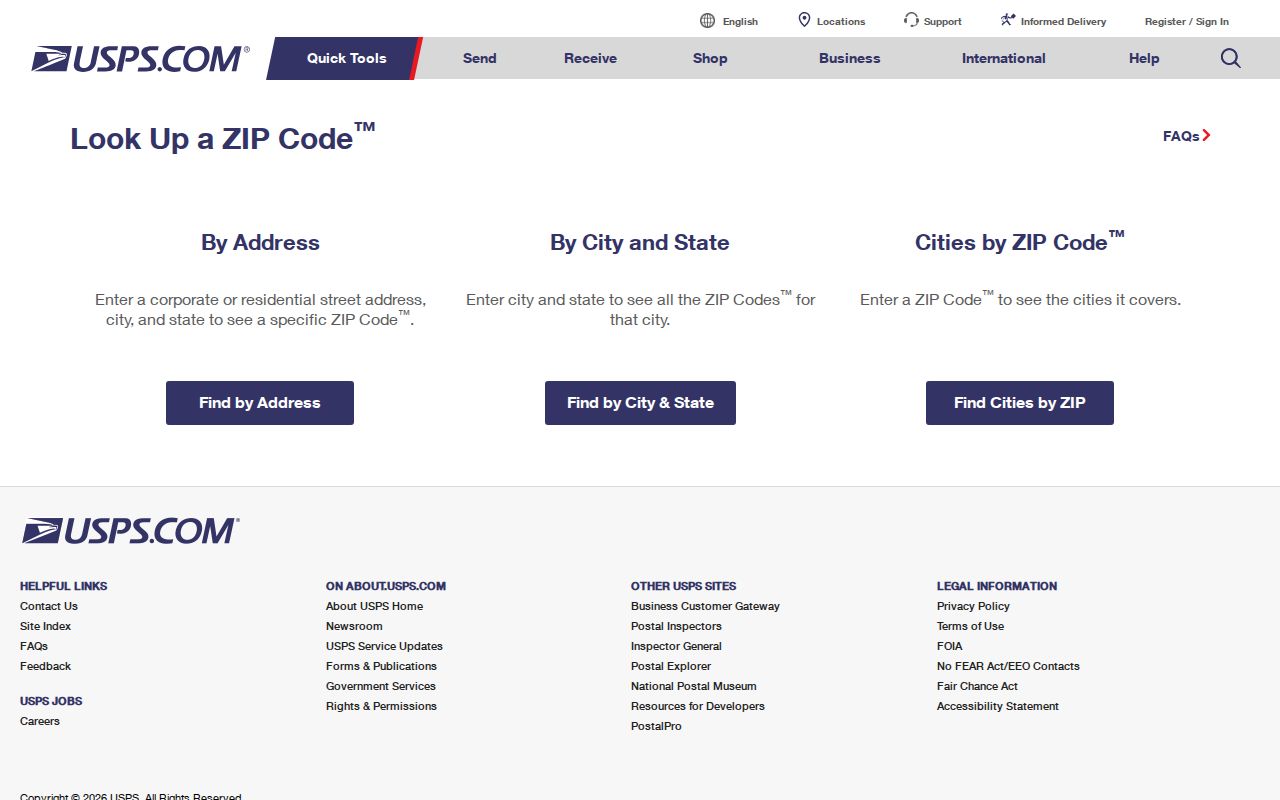
Use the recognized city name returned by USPS as a delivery check, then keep the municipality from the assessor or parcel record for public-record research.
Find Residents by Plymouth County ZIP
A ZIP narrows the area, but no verified countywide person roster accepts it as a universal filter. Start with USPS to standardize the address and municipality. Then use the relevant town's assessor, map, clerk, and public-record channels. Plymouth WebPro does not show ZIP as a primary search field. Its result detail does show mailing address city, state, and ZIP, so property results can be grouped after a street, owner, parcel, or neighborhood search. The statewide voter-status form requires an exact residential ZIP, but it is for a voter checking that person's own status, not a countywide directory.
- Confirm the address and postal form through USPS, then note the legal municipality.
- Search that municipality's assessor by street, street number, owner, parcel, or local neighborhood field.
- Keep the parcel location separate from a property mailing address and group returned records by ZIP only after reviewing the result.
- Use the municipal election office for lawful public voter-file requests, specifying town, format, date, and public fields.
- Use GIS for street and parcel context, then verify a parcel boundary with the deed or plan where needed.
The Massachusetts voter-status form requires first name, last name, date of birth, residential ZIP, and an acknowledgment. Municipal lists have separate rules and exclude confidential voters and other protected information. Once a ZIP leads to a named street, the Plymouth County street directory path handles the address-level record trail.
Plymouth County ZIP Assessor Results
The Plymouth Patriot Properties WebPro search is the county's concrete municipal example. Available inputs include parcel, owner, street name, street number, building type, year-built range, beds, baths, lot size, finished area, neighborhood, land-use code, description, total-value range, sale-price range, sale-date range, and book/page. The online file is updated once a year, and the assessor office keeps the most current data. Other Plymouth County municipalities use their own assessor systems, not one countywide portal.
WebPro results can show parcel ID, location, owner, built year, type, value, lot and finished area, neighborhood, sale date, sale price, and book/page. A full card may show the current property mailing address, zoning, grantor, legal description, and parcel map or sketch. The situs is the physical parcel location. A mailing address is where the tax record goes and can differ from the situs, so it should never be rewritten as proof that someone lives there.
The Plymouth assessor search screen demonstrates why records must be found by municipal address fields before ZIP grouping.
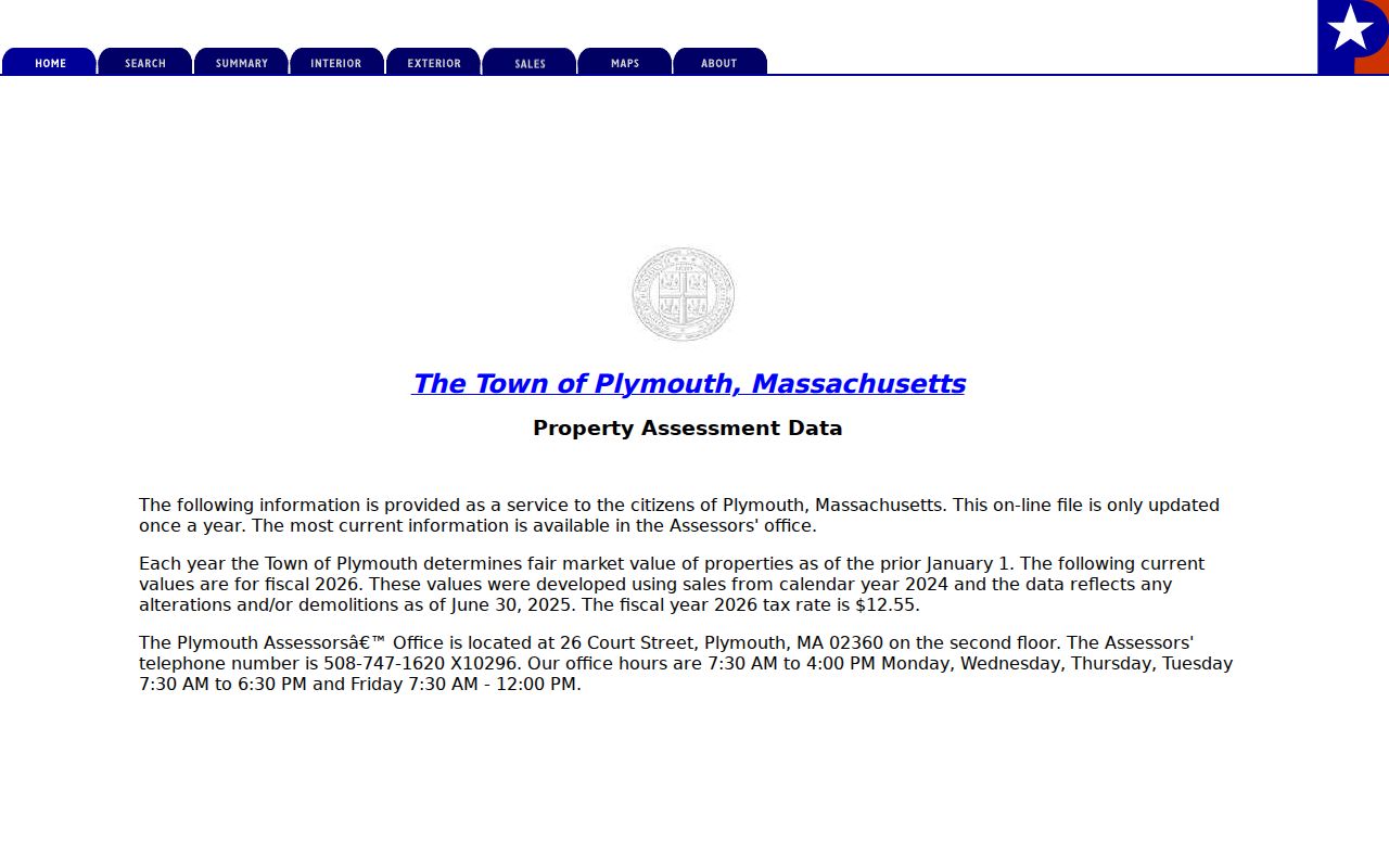
The displayed search choices support street and parcel research, while ZIP appears later in a property record's mailing-address detail.
Plymouth County ZIP Map Caveats
Use a map layer to compare broad areas, not to set a legal boundary. Plymouth's ToPGIS page links parcels, street addresses, aerial photographs, MassGIS property maps, and related state layers. It also warns that parcel lines are graphic representations, sources vary in currency, and placement errors of 50 feet or more can occur. A map can help identify a street segment or adjoining parcel, but the deed and plan remain the proper tools for a legal description.
The captured MassGIS ZIP data page states the policy limits that accompany the state layer.
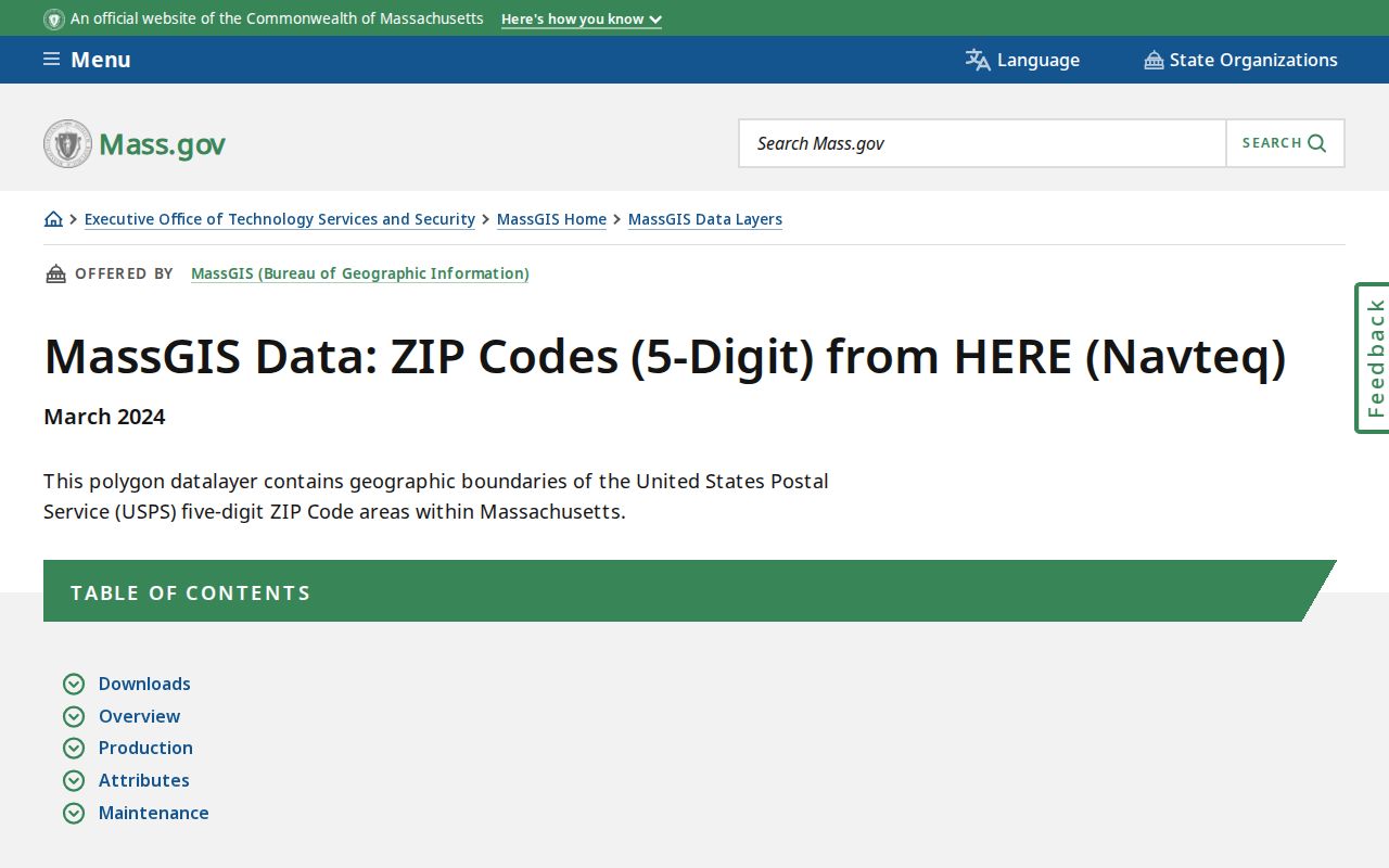
The note supports an important check: an approximate polygon cannot settle whether a delivery point belongs to a ZIP, a town, or a specific parcel.
Plymouth County ZIP Localities
Locality labels are practical search keys. The County officers booklet maps Manomet, Cedarville, North Plymouth, White Horse Beach, Brant Rock, Green Harbor, Greenbush, Minot, North Scituate, Bryantville, North Pembroke, North Carver, Onset, East Wareham, and West Wareham to their municipalities. Those names may appear in an older directory, a deed, a historic-house file, a postal label, or a current conversation about an address. They should be preserved before a researcher converts them to a modern town or ZIP.
For example, 02345 is captured for Manomet/Plymouth and 02381 for White Horse Beach/Plymouth, while 02558 is a PO Box locality label for Onset/Wareham. Greenbush, Brant Rock, and North Scituate likewise point to distinct town contexts. A county label alone is too broad for tax, permit, voter, cemetery, or clerk records. Match the locality to its municipality first, then use the local custodian.
Plymouth County ZIP Boundary Limits
Delivery ZIPs and municipal limits answer different questions. A ZIP tells USPS how to route mail. A municipality identifies the town responsible for a property card, street records, town-clerk materials, and many local public records. Plymouth is geographically large and contains Plymouth Center or Village, North Plymouth, West Plymouth, South Plymouth, Manomet, Cedarville, White Horse Beach, and Pinehills-area references. A historic street, plan, lot, book/page, and municipality can be more stable than a current postal string.
- ZIP vs. ZIP+4
- A five-digit ZIP identifies a delivery area. ZIP+4 adds a more specific delivery segment, such as a block or receiving point.
- PO Box ZIP
- A ZIP assigned for post-office-box delivery. It is not interchangeable with a standard street-delivery ZIP.
- Unique ZIP
- A ZIP assigned to a particular organization or delivery arrangement rather than ordinary neighborhood street delivery.
- Carrier route
- A USPS delivery sequence used for mail handling. It is not a legal parcel boundary or municipal district.
No official countywide readdressing authority, address-maintenance portal, or street-renumbering chronology was located. When an address changes form, use the town assessor, planning office, Registry plans, local atlases, MACRIS, and library street index instead of guessing a conversion year. Note: A ZIP match is a delivery clue, never complete evidence about a person or legal property boundary.
Historical Plymouth County ZIP Caution
Historic directories do not use today's ZIP grid. Their street and locality lines can name a village, an old road, a lot description, or a nearby town. Convert an old entry only after matching the street, municipality, plan, and map context. The 1909 Plymouth resident and business directory, the State Library's uneven runs, historic-house binders, and the March 1891 Sanborn sheets are historical sources. They should not be forced into a present postal label before the place itself is identified.
For a well-supported address history, preserve the original locality, find the municipal parcel and legal description, verify the modern delivery ZIP with USPS, then compare map and directory evidence. This sequence respects both records systems: historic sources explain the past location, while the postal tool explains current delivery. It also avoids treating a modern ZIP as proof that an old household stayed within the same town or county boundary.